Mapping the Future: SLC Volunteers Use 360-Degree Camera to Enhance Open Street Maps for MVGR
In the ever-evolving landscape of digital mapping, the integration of cutting-edge technology is paramount to creating comprehensive and accessible maps for the public. Recently, the Swecha Learning Center (SLC) at MVGR College of Engineering took a significant step in this direction with the donation of a 360-degree camera, transforming the way we capture and share street-level imagery. This blog delves into how this initiative, spearheaded by dedicated SLC volunteers, is enhancing Open Street Maps (OSM) and providing a richer, more immersive experience for users.
The Power of 360-Degree Imagery
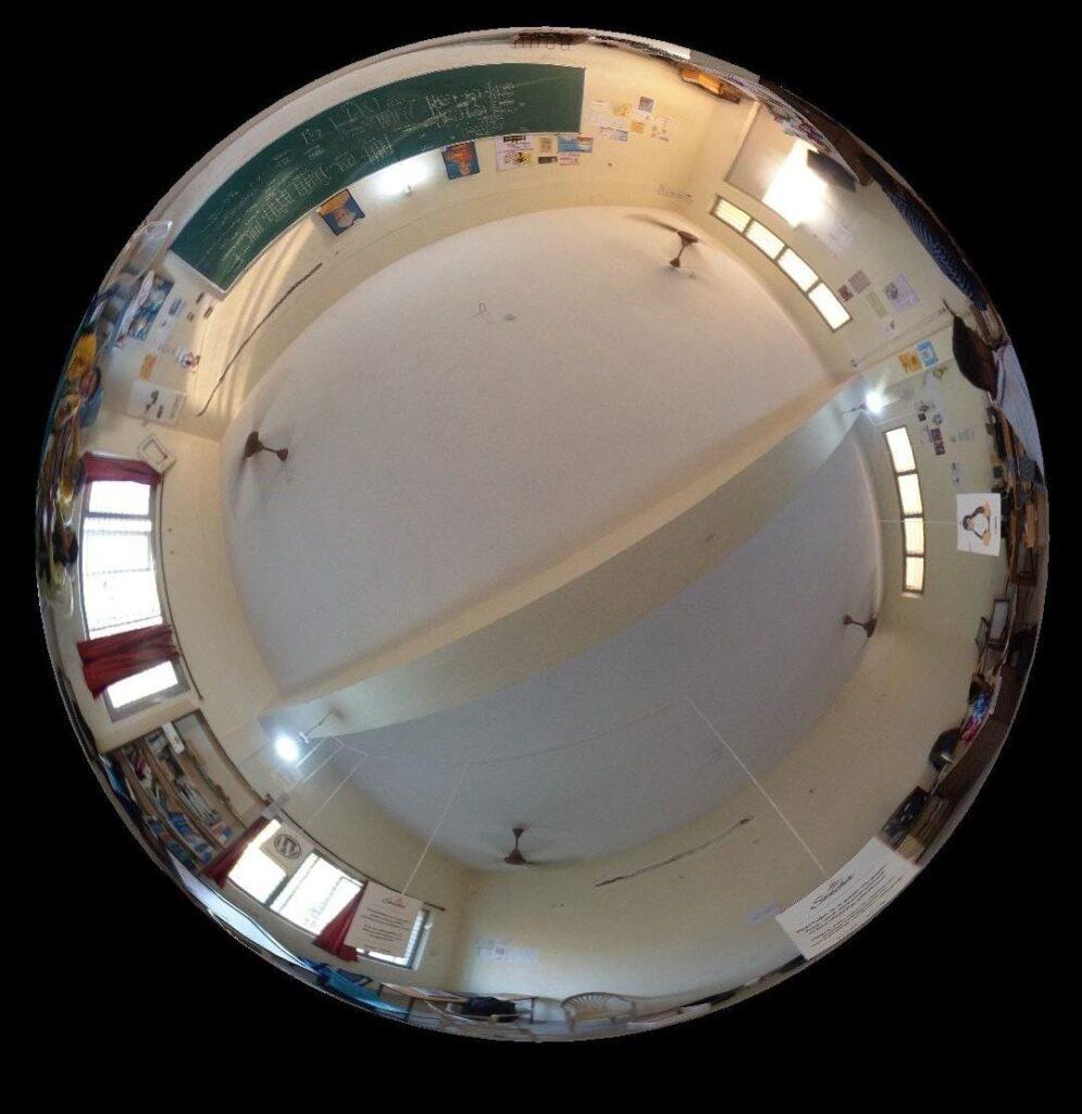
Traditional mapping methods often fall short in capturing the intricate details of our environments. Enter the 360-degree camera, a technological marvel that records panoramic views, allowing for an immersive exploration of locations. This technology offers a comprehensive perspective, making it invaluable for creating detailed and interactive maps.
Empowering SLC Volunteers
- Camera Operation: Understanding the functionality and features of the 360-degree camera.
- Image Capture Techniques: Learning the best practices for capturing clear, comprehensive street views.
- Data Integration: Uploading and integrating the captured images into Open Street Maps, ensuring they are accessible to users worldwide.
Capturing MVGR’s Essence
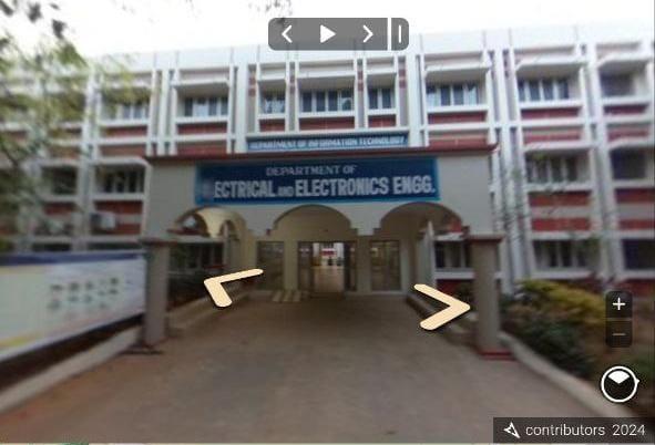
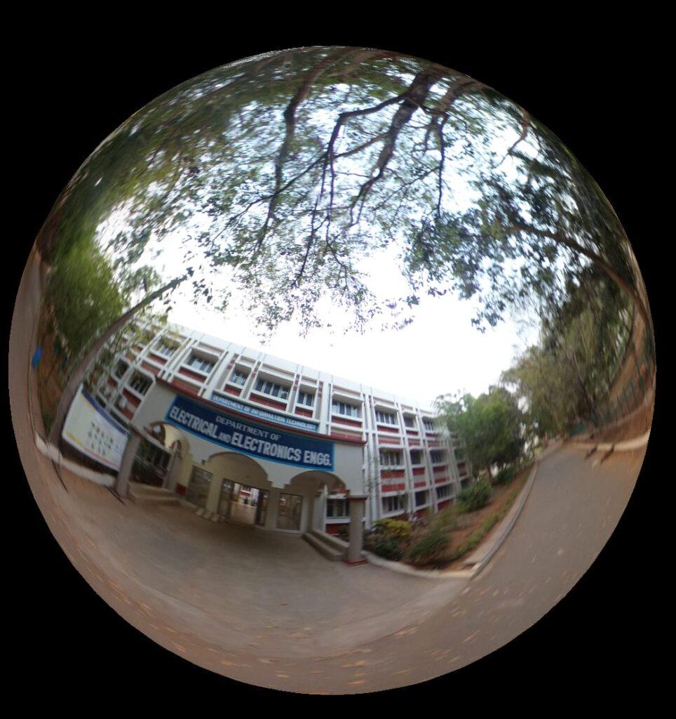
With the training complete, SLC volunteers embarked on a mission to document the MVGR campus and its surrounding areas. The 360-degree camera allowed them to capture the essence of the campus, from bustling academic buildings to serene green spaces. These images provide a virtual tour experience, enabling users to explore the campus as if they were physically present.
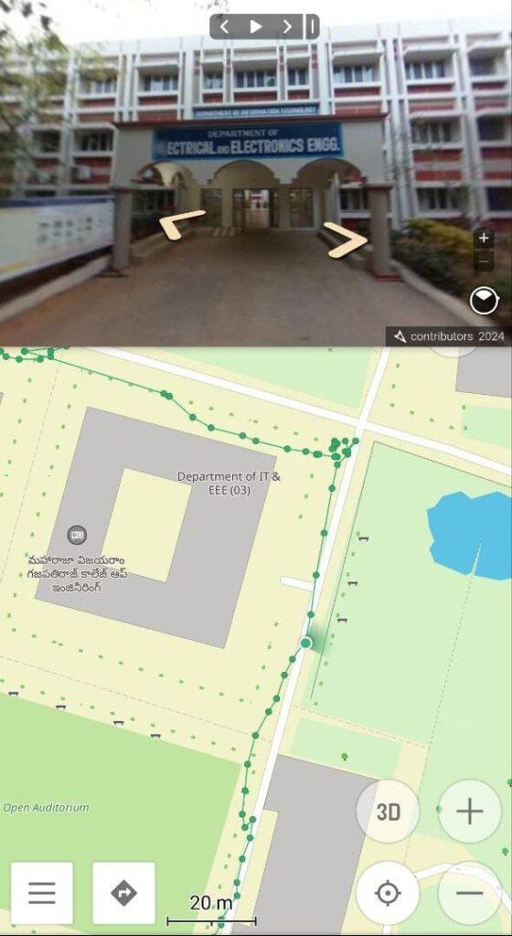
Enhancing Open Street Maps
Open Street Maps is a collaborative project that aims to create a free, editable map of the world. By uploading the 360-degree images to OSM, SLC volunteers have significantly enriched the platform’s data for MVGR. This enhancement offers several benefits:
- Improved Navigation: Detailed street views help users navigate the campus and its environs more effectively.
- Accessible Information: Prospective students, visitors, and the general public can explore MVGR remotely, gaining valuable insights into the campus layout and facilities.
- Community Engagement: The initiative fosters a sense of community involvement, encouraging others to contribute to OSM and support the continuous improvement of digital maps.
Participants:
K Tanooj (21331A0592)
K Mokshagna Anurag (22331A0473)
T.Rupeswari (23335A0516)
A.Gayathri (23335A0501)
Ch.Karuna (23335A0407)